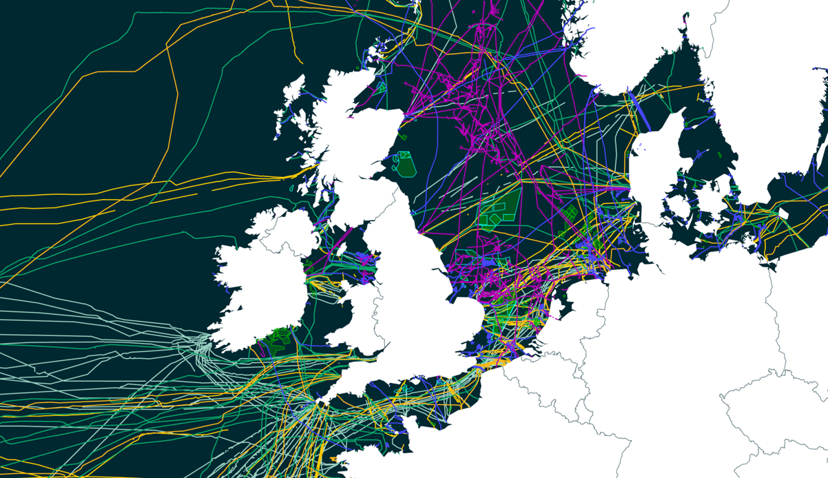
When planning new cable systems, dealing with cable crossings can be complex and if preparation is done incorrectly, can result in huge repair costs for existing cables in the surrounding infrastructure. Submarine cable maps help identify the existing cables on the seabed, which alongside many other factors. For example, the physical attributes of the area, selection of suitable landing points, dredging areas and marine protected areas, all take part in influencing the best possible route to take when laying a cable.
Having accurate cable data is paramount to carrying out a successful subsea operation. Take a listen to our subsea experts, Brian Perratt, Global Support Services Manager and Stuart Wilson, Route Engineering Survey Manager, who took a look into the challenges cable crossings bring to a cable system. As well as, other factors to consider when planning for a complex subsea project.
Below we show a detailed view of the North Sea and its cable crossings, using a submarine cable map.
At OceanIQ®, we recently carried out a study for a cable system across the North Sea, which crossed 16 pipelines, 6 power cables, 11 in service telecom cables and 10 out of service cables.
We’re having to share the seabed like never before. The increasing growth of offshore renewables alongside the insatiable demand for global connectivity is having an impact on the existing and new cable infrastructure. GeoCable® GIS Data provides an understanding of where existing cables are on the ocean floor against any geographical and human risks.
Following the increase in seabed usage from industries such as telecoms, renewable energy, oil & gas and resource mining, our seabed congestion data prevents risks to both the security of the cable and to the process of acquiring permits.
Comprehensive cable data is critical to feed into detailed route development, effective crossing strategies and successful cable protection approaches for future systems. Overall, saving your project time and extra costs.